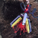
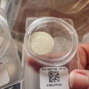
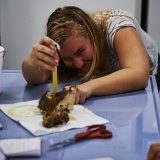
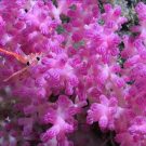
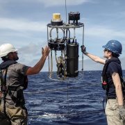
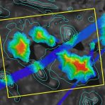
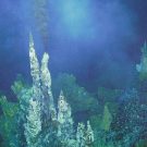
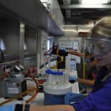
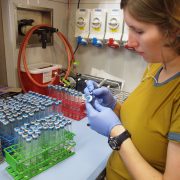
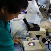
Tested and refined new soft robotics actuators for collection of fragile samples, aptly named “squishy fingers,” that were fabricated aboard the ship using 3D printing.
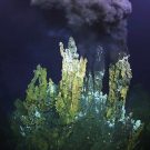
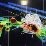
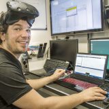
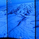
Collected 200,000 images to complete a 3D reconstruction of a hydrothermal vent field to enable users to visualize the data using virtual reality technology.
Supported the development of a web-based marine scientific image annotation software, Squidle+, by Grey Bits that gathers image tags to train deep learning habitat characterization algorithms, and its shipboard version for annotation of ROV image data in real time.
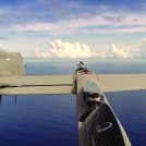
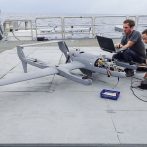
A high endurance and high payload vertical take-off and landing robotic aerial vehicle was launched, recovered, and successfully operated for the first time from a research ship in the open ocean environment.
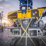
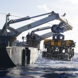
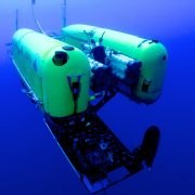
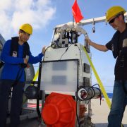
Designed, developed, tested, and put into full operation a 4,500 meter science work class dedicated remotely operated vehicle, SuBastian, equipped with 4K image collection capabilities, which allowed livestreaming of never-before-seen footage of deep coral and hydrothermal vent systems.
Collected the first measurements of sea surface skin salinity with an unmanned aerial vehicle, demonstrating that the surface microlayer of the ocean is saltier than originally thought.
Pioneered new ways to trace phytoplankton with cutting-edge instruments such as the NASA-funded Flowthrough Extended Range Particle Sizer (FERPS). The collected data is used to create remote sensing algorithms reducing uncertainties in biogeochemical models.
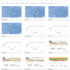
Supported the development of Open Vessel Data Management (OpenVDM) software by Ocean Data Rat, which organizes all oceanographic data gathered on research vessels and allows technicians and public to view data in real-time both on the ship and online.
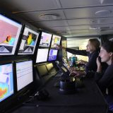
Falkor was the first research vessel to have installed a high performance computing (HPC) system permitting shipboard scientists to model collected data in real-time and make informed decisions about where to conduct at-sea research.
Mapped 35% of the United States’ Papahᾱnaumokuᾱkea Marine National Monument, as part of the efforts that lead to its historic expansion that quadrupled its size and made it the largest marine national monument of the United States.
Researchers at sea visualized phytoplankton for the first time with virtual reality in 3D, allowing the science team on Falkor and collaborators on shore to interactively immerse themselves into the unique holographic data.
Researchers collected ancient coral specimens that lived 10,000-20,000 years ago. Radiometric dating of the coral skeletons will allow scientists to reconstruct the timing of sea level change and predict future rates of sea level rise.
Completed the first comprehensive survey of the eastern seamounts in the UNESCO World Heritage Site Phoenix Islands Protected Area, conducting the largest inventory of species distributed by depth and discovering two new species.
Supported the first use of proteomics using biomarkers and mass spectrometers for the diagnosis of oceanic changes instead of medical aspects to track long-term changes in microbial communities in expanding oxygen minimum zones. The resulting dataset is thought to be the largest, most complete protein dataset yet for the oceans.
Produced high resolution seafloor maps for more than 11,000 square kilometers of the United States’ Johnston Atoll Unit which were used to strategically guide robotic submersibles on a follow up cruise aboard a ship US government research vessel to characterize the living and non-living resources.
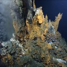
Discovered and mapped ten new underwater eruption deposits in the Tonga subduction zone within the waters of the Kingdom of Tonga, including three new hydrothermal chimney systems and several diffuse venting sites.
Demonstrated the feasibility of using ROVs as an accurate and low-impact fisheries assessment tool and helped to inform the management of artificial reefs in a way that allow the surrounding fish communities to thrive.
[Ajemian, M.J., et al. (2015). Rapid assessment of fish communities on oil and gas platform reefs using remotely operated vehicles. Fish. Res. 167: 143-155, doi:10.1016].
Documented the response of deep-water corals to oil–dispersant mixtures following the Gulf of Mexico Deepwater Horizon oil spill, providing evidence of their toxicity and information that can be used in future spill intervention
[DeLeo, D.M., et al. (2015). Response of Deep-water Corals to Oil and Chemical Dispersant Exposure. Deep Sea Research II. doi: 10.1016/j.dsr2.2015.02.028].
Demonstrated that Earth’s sea level did not rise steadily during the last glacial melt giving evidence to quick sea level impacts [Nauels, A., et al. 2017. Linking sea level rise and socioeconomic indicators under the Shared Socioeconomic Pathway. Environmental Research Letters 12 114002]. This suggests that past sea level rose by tens of millimeters annually, far beyond the current prediction, and may impact future sea level models.
[Khanna, Pankaj, et al. 2017. Coralgal reef morphology records punctuated sea-level rise during the last deglaciation. Nature Communications 1046 (8), doi:10.1038/s41467-017-00966-x].
Produced the first seafloor maps of the Campeche Escarpment, looking at one of the largest meteor impacts in high resolution resulting in a better understanding of Earth’s history [Paull, C.K., et al. 2014. Cretaceous–Paleogene boundary exposed: Campeche Escarpment, Gulf of Mexico. Marine Geology 357, 392-400] and identifying sediment failures in Mexican waters and potential tsunami impacts in the Gulf of Mexico.
[Chaytor, J.D., et al. (2016). Source Characterization and Tsunami Modeling of Submarine Landslides Along the Yucatán Shelf/Campeche Escarpment. Pure Appl. Geophys. 173: 4101, doi: 10.1007/s00024-016-1363-3].
Discovered a new form of low-temperature seafloor fluid flow in the Mid-Cayman Rise within the Cayman Trough and extended the known range of physical conditions under which seafloor hydrothermal venting can exist.
Studied microbes that live beneath the seafloor at Axial Seamount off the US West Coast, leading to an understanding of how these communities alter the flow of carbon and nutrients, and revealing high taxonomic diversity.
[Topçuoğlu B., et al. (2016). Hydrogen Limitation and Syntrophic Growth among Natural Assemblages of Thermophilic Methanogens at Deep-sea Hydrothermal Vents. Front. Microbiol. 7:1240. doi:10.3389/ fmicb.2016.01240].
Demonstrated that faunal communities in the Mariana Trench are zoned by depth and made up of heterogeneous environments. This has implications for conservation such that a trench cannot be thought of as a single habitat.
Discovered the presence of high pollutant concentrations in trench species showing that hadal environments are not immune to anthropogenic influences
[Jamieson, A., et al. (2017). Bioaccumulation of Persistent Organic Pollutants in the Deepest Ocean Fauna. Nature Ecology & Evolution, 1:0051, doi:10.1038/s41559-016-0051]
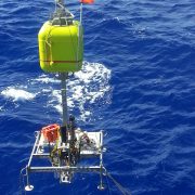
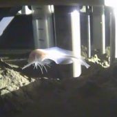
Identified a new hadal snailfish species, Pseudoliparis swirei, at a record depth with SOI’s 11,000 meters capable elevator lander systems.
Hosted the first tests of pressure-retaining samplers and successfully collected microbes and amphipods at 10,900 meters. Results indicated that certain species have genetic adaptation to hadal environments [Lan, Y., et al. (2017). Molecular Adaptation in the World’s Deepest-living Animal. Mol. Ecol. 26:14, DOI: 10.1111/mec.14149].
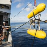
Demonstrated advanced autonomy in multi-platform robotic operations to support intelligent, scale-able, and cost-efficient survey and characterization of marine environments, working towards reducing effort, time, and resources for ocean monitoring, exploration, and conservation.
Captured new faults along the Wharton Basin off the west coast of Indonesia, which may indicate that parts are subducting at different rates, causing strain in the plate boundaries [Singh, S., et al. (2017). The Discovery of a Conjugate System of Faults in the Wharton Basin Intraplate Deformation Zone, Science Advances 2017 3: no. 1, doi: 10.1126/sciadv.1601689]. These findings updated tsunami hazard models, potentially protecting the lives of many that live along the coastal regions
Completed the first comprehensive view of geologic, chemical, and biological diversity along the Mariana back-arc region, including the discovery of four new vent sites and the deepest historical eruption in the back-arc at 4,100-4,450 meters. This information will be used by managers of the United States’ Mariana Trench Marine National Monument [Baker, E., et al. (2017). The Effect of Arc Proximity on Hydrothermal Activity Along Spreading Centers. Geochem. Geophys. Geosyst. doi:10.1002/2017GC007234].
Collected biological and chemical data for contribution to a ten-year time series about hydrothermal vent sites in the Lau Basin. The vents were shown to have stable habitats, which contrasts previous assumptions that vents are unstable and can recover quickly from perturbations such as deep sea mining [Du Preez, C. and C. Fisher. (2018). Long-Term Stability of Back-Arc Basin Hydrothermal Vents. Frontiers of Marine Science, 5:54, doi: 10.3389/fmars.2018.00054].

